Line Defined
A “line” was a “boundary line” between lands, for example between Bountiful and Desolation.
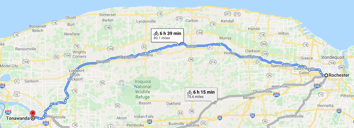
32 And now it was only the distance of a day and a half’s journey for a Nephite on the line Bountiful and the land Desolation, from the east to the west sea and thus the land of Nephi and the land of Zarahemla were nearly surrounded by water there being a small neck of land between the land northward and the land southward. (Alma 22:32)
3 And the land which was appointed was the land of Zarahemla and the land which was between the land Zarahemla and the land Bountiful yea to the line which was between the land Bountiful and the land Desolation. (3 Nephi 3:23)
A “line” could also be a “fortified line”:
7 And there they did fortify against the Lamanites, from the west sea even unto the east it being a day’s journey for a Nephite on the line which they had fortified and stationed their armies to defend their north country. (Helaman 4:7; this was not the Line Bountiful)
Line Described
For foot travel, to get from the west to the east was a short distance—only a day and a half. This meant that the cities Mulek and Bountiful were close to each other, just not on the same side. It says that between them were “plains”:
20 And it came to pass they sent embassies to the army of the Lamanites which protected the city of Mulek to their leader whose name was Jacob desiring him that he would come out with his armies to meet them upon the plains between the two cities but behold Jacob who was a Zoramite would not come out with his army to meet them upon the plains. (Alma 52:20)
Those plains appear to be the result of an evaporating inland sea or lake – Lake Tonawanda:
Marshes: The great Tonawanda Swamp, which extends over portions of Genesee and Niagara counties, lies partly in this (Orleans) county. It is twenty five miles in length from east to west, and from two to seven in breadth. It is bounded on all sides by plains a little elevated above its surface. (J. H. Mather, and L. P. Brockett, M. D., A geographical history of the state of New York: embracing its history, government, physical features, climate, geology, mineralogy, botany, zoology, education, internal improvements, &c. With a separate map of each county. The whole forming a complete history of the state. Utica, John W. Fuller & Co., 1851, p. 400) Map
This is why the travel between the east and western sides was easier, there was a flat plain. As stated in the above description of the Buffalo Creek Reservation:
The Buffalo Creek Reservation was in general a flat plain tilted upward to the east…it rose gradually to the flat plains about Marilla (“Buffalo Creek Reservation,” Buffalo Historical Society Publications, Vol. 24, 1920, p. 6).
They crossed no rivers on the Line Bountiful between the cities Bountiful and Mulek. This was quite perplexing for Book of Mormon scholar J.N. Washburn (The Contents, Structure and Authorship of TBOM, Bookcraft, 1954) as he said:
Why is no mention made of the river there when so much was going on? It was the territory of much of the missionary activity of Alma and his companions. It was near Mulek and Bountiful (possibly the boundary line between them) where everything appeared to happen. It seems inevitable that it was directly in the path of Amalickiah’s blitzkrieg, that it must have been in the way of the Ammonites, of the fleeing Moriantonites. Yet nothing is said about it in all these travels. (p. 242)
Perhaps someone can help with the solution of this problem. (p.243)
The solution was already described above. If we respect what it says about the City Bountiful being on the west side and not assume the River Sidon emptied into the East Sea, there is no problem. In other words, it proves the River Sidon emptied into the West Sea.
The trails described also match those in The Book of Mormon:
Cutting through the wilderness of woods were numerous paths, which connected the scattered cabins, and opened communication with other far-away communities. Some of these were transient and dim, paths only between fields and homes. Others were deeply marked trails, trodden and scored by generations of soft-shoud aboriginal wayfarers.
These permanent trails led along the banks of all the water courses and evenutally converged at the mouth of Buffalo Creek, where they joined the great main traveled way which followed the shore of Lake Erie to the west and continued along the banks of the Niagara to Lake Ontario. (“Buffalo Creek Reservation,” Buffalo Historical Society Publications, Vol. 24, 1920, p. 11)
The Empire State, as you love to call it, was once laced by our trails from Albany to Buffalo, – trails that we had trod for centuries – trails worn so deep by the feet of the Iroquois that they became your roads of travel, as your possessions gradually eat into those of my people. Your roads still traverse those same lines of communication which bound one part of the Long House to the other. (William M. Beauchamp, “Perch lake mounds, with notes on other New York mounds, and some accounts of Indian trails,” New York State Museum Bulletin 87, Archeology 10, 1905 p. 47 (see “Trails,” pp. 33-47))
It makes sense that the highways, roadways, and pathways during Book of Mormon times would have followed the rivers and lakes as well. One such highway was to the north. It was called the Narrow Passage.
Line Distance
The distance on the line between Bountiful and Desolation from one sea to the other was 1.5 days. It’s assumed that the distance described was for a foot traveler, not a runner, horse, army, or chariot. The verse referenced “a Nephite” which simply acknowledged it was the pace for a single person.
The distance in miles is open to debate. The expression “a day and a half’s journey” is found in the Bible and was used by the American Indians:
A Day’s Journey (Luke 2:44). According to Bishop Cumberland, the day’s journey was thirty-three English miles, one furlong, and five hundred and forty-four yards; and Lightfoot says, a day’s march to the festivals was thirty miles for individuals, and ten miles for companies. A sabbath day’s journey was reckoned 2,000 cubits, or nearly three quarters of an English mile (The Religious Tract Society, Eastern Arts and antiquities Mentioned in the Sacred Scriptures, London, 1840, p. 384).
For comparison:
Arrian tells us, that Alexander marched from the lake Alexander to Celaene in five days. This is, according to D’Anville’s ancient map of Asia Minor, 1250 Olympic stadia, and 143 English miles by Rochette’s map, and the fame by D’Anville’s modern map of Asia Minor. This makes 250 stadia, or 28.5 English miles, for each day’s march, allowing nothing for the winding of the road. If 1/3 be allowed on that account, each day’s march will be 280 stadia, equal to 32 English miles. Herodotus tells us, that 200 stadia, or 25 Greek miles, equal to 22.893 English miles, was a day’s journey for a foot traveller; and that 150 stadia, or 18 3/4 Greek miles, was a day’s march for an army. Strabo assigns 250, or even 300, stadia for a day’s journey for a foot traveller; and Procopius mentions 210 as the usual computation. Vegetius, at a time when the Roman discipline began to decline, says, that the usual daily march of the army was 20 miles, which was performed in five hours; and that if they accelerated their pace, they could march 24 miles in the same time…Vegetius tells us, that in his time the weight of the armour and provisions, which was carried by the Roman soldiers on their long marches, amounted to 60 pounds (Arrian’s voyage round the Euxine Sea, translated by Arrian, William Falconer, Thomas Falconer, 1805, pp. 159-160).
Depending on the time of year, load of the pack, and purpose of the journey, travel times could vary greatly. A soldier, marching in a group, with a 60 lb pack could cover nearly 5 miles per hour. A 12-16 hour hike (sunrise to sunset) could garner 48/66–60/80 miles a day, plus one half-day (sunrise to noon) 24–30 miles for a potential total of 72/90–96/110 miles or average of 81–103 miles.
See also: